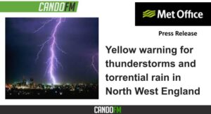
While some places stay dry, others are likely to see thunderstorms with torrential rain during Tuesday, bringing possible disruption.
What to expect
- Spray and sudden flooding could lead to difficult driving conditions and some road closures
- There is a chance that homes and businesses could be flooded quickly, with damage to some buildings from floodwater, lightning strikes, hail or strong winds
- There is a slight chance that power cuts could occur and other services to some homes and businesses could be lost
- There is a small chance of fast flowing or deep floodwater
- Where flooding or lightning strikes occur, there is a chance of delays and some cancellations to train and bus services
Whilst some places will miss them, thunderstorms and areas of heavy rain seem likely to develop quite widely on Tuesday across parts of England and Wales. 20-30 mm of rain is possible within an hour, but where areas of thundery rain become slow-moving, some places could see 50 mm in less than three hours. There is a low probability that higher totals could occur in a few spots over the course of the day, while hail and frequent lightning are likely additional hazards for some places. There is considerable uncertainty at this stage in regional and county level focus.


